Log in
All resources
Create a design
338 Free Artworks of 1830 Maps
maps from the earth and its inhabitants, vol. iv
maps from the earth and its inhabitants, vol. xviii
maps from the earth and its inhabitants, vol. xiv
maps from the earth and its inhabitants, vol. x
maps from the earth and its inhabitants, vol. iii
1894 in peru
1880s maps of egypt
1894 in chile
1894 maps of south america
1886 maps of africa
19th-century maps of maastricht
maps in hcl (maastricht)
maps from the earth and its inhabitants, vol. iv
bathymetric maps of the united kingdom
maps by juan lopez
1835 maps of spain
maps by daniel lizars
1831 maps of mexico
maps from the earth and its inhabitants, vol. iv
geological maps of the united kingdom
maps from the earth and its inhabitants, vol. xviii
maps of the ancash region
maps from the earth and its inhabitants, vol. iv
1880s maps of england
the gazetteer of scotland (1838)
william home lizars
1880s maps of the netherlands
1880s maps of belgium
maps from the earth and its inhabitants, vol. v
19th-century maps of scandinavia
maps from the earth and its inhabitants, vol. iv
old maps of the east riding of yorkshire
maps from the earth and its inhabitants, vol. iv
old maps of kingston upon hull
maps by gouverneur k. warren
maps by edwin freyhold
maps from the earth and its inhabitants, vol. xiv
blitar
maps from the earth and its inhabitants, vol. xviii
llanquihue
1804 maps of europe
maps by john cary
maps from the earth and its inhabitants, vol. iv
ragstone
maps from the earth and its inhabitants, vol. iv
faversham creek
pierre antoine tardieu
heinrich keller
maps from the earth and its inhabitants, vol. iv
1880s maps of ireland
maps from the earth and its inhabitants, vol. xviii
old maps of lima
maps from the earth and its inhabitants, vol. xviii
1890s maps of peru
maps from the earth and its inhabitants, vol. xiv
maps of sumbawa
maps from the earth and its inhabitants, vol. iii
old maps of bonn
maps from the earth and its inhabitants, vol. xviii
1894 in peru
maps from the earth and its inhabitants, vol. iv
kingsmead, bath
maps from the earth and its inhabitants, vol. iv
ragstone
maps from the earth and its inhabitants, vol. iv
topographic maps of scotland
maps from the earth and its inhabitants, vol. xvi
1890s maps of belize
maps from the earth and its inhabitants, vol. iv
amesbury
maps from the earth and its inhabitants, vol. x
19th-century maps of cairo
constantinople and the scenery of the seven churches of asia minor illustrated (1836-38)
1830s maps of turkey
maps from the earth and its inhabitants, vol. x
1880s maps of egypt
maps from the earth and its inhabitants, vol. x
1886 maps of africa
maps from the earth and its inhabitants, vol. iv
maps of balmoral castle
maps from the earth and its inhabitants, vol. x
1880s maps of egypt
the gazetteer of scotland (1838)
edinburgh in art
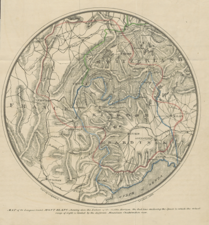
narrative of an ascent to the summit of mont blanc (1830)
maps of massif du mont-blanc
maps from the earth and its inhabitants, vol. iv
old maps of cardiff
maps from the earth and its inhabitants, vol. iv
1880s maps of london
maps from the earth and its inhabitants, vol. iv
maps of penzance
maps from the earth and its inhabitants, vol. x
1880s maps of egypt
maps from the earth and its inhabitants, vol. iv
19th-century maps of surrey
maps from the earth and its inhabitants, vol. iv
turlough
carte des régences d'alger by hérisson
bibliothèque nationale de france
maps from the earth and its inhabitants, vol. xiv
catbalogan
maps from the earth and its inhabitants, vol. iv
maritime maps of the united kingdom
the hand-book for travellers in italy, from london to naples (1838)
old maps of tuscany
maps from the earth and its inhabitants, vol. iv
maps of balmoral castle
maps from the earth and its inhabitants, vol. xiv
1890s maps of australia
maps from the earth and its inhabitants, vol. xiv
1890s maps of new zealand
maps from the earth and its inhabitants, vol. iv
old maps of cardiff
maps from the earth and its inhabitants, vol. xiv
1890 maps of africa
maps from the earth and its inhabitants, vol. x
1880s maps of egypt
maps from the earth and its inhabitants, vol. iii
1880s maps of vienna
19th-century maps of nicaragua
bedford pim
maps from the earth and its inhabitants, vol. iv
old maps of hastings, england
maps from the earth and its inhabitants, vol. xiv
1890s maps of indonesia
maps from the earth and its inhabitants, vol. xiv
old maps of adelaide
1831 maps of new york (state)
old maps of lower manhattan
maps from the earth and its inhabitants, vol. iv
1880s maps of ireland
media contributed by university of illinois urbana-champaign university library
carte du mexique et de la floride by guillaume delisle (1703)
travels in the interior of north america, during the years 1832–1834
works by maximilian zu wied-neuwied
maps from the earth and its inhabitants, vol. iv
severn estuary
maps from the earth and its inhabitants, vol. iv
mount merrick
the history and antiquities of london, westminster, southwark and parts adjacent
old maps of the london borough of southwark
maps from the earth and its inhabitants, vol. iv
falmouth bay
maps from the earth and its inhabitants, vol. iii
old maps of hungary
maps from the earth and its inhabitants, vol. xviii
old maps of bogotá
maps from the earth and its inhabitants, vol. xviii
1894 in chile
maps from the earth and its inhabitants, vol. iv
montrose, angus
maps from the earth and its inhabitants, vol. xviii
1894 in peru
maps from the earth and its inhabitants, vol. iv
dublin bay
maps from the earth and its inhabitants, vol. iv
milford haven
maps from the earth and its inhabitants, vol. iii
maps of blankenberge
maps from the earth and its inhabitants, vol. xiv
magelang
maps from the earth and its inhabitants, vol. xviii
1894 in chile
maps from the earth and its inhabitants, vol. v
1880s maps of iceland
maps from the earth and its inhabitants, vol. xviii
1894 in chile
18th-century portrait paintings in the national maritime museum, london
john francis rigaud
maps from the earth and its inhabitants, vol. iii
old maps of denmark
maps from the earth and its inhabitants, vol. x
kassala
maps from the earth and its inhabitants, vol. xiv
maps of batangas
maps from the earth and its inhabitants, vol. iv
old maps of norwich
maps from the earth and its inhabitants, vol. iv
old maps of sheffield
maps from the earth and its inhabitants, vol. iv
1882 maps
maps from the earth and its inhabitants, vol. iv
old maps of cambridge
maps from the earth and its inhabitants, vol. iv
1880s maps of london
maps from the earth and its inhabitants, vol. iv
1881 maps
maps from the earth and its inhabitants, vol. iv
old maps of lincoln
maps from the earth and its inhabitants, vol. xviii
1890s maps of colombia
citadelle de québec in art
1830 in quebec
maps from the earth and its inhabitants, vol. xviii
1894 maps of south america
maps from the earth and its inhabitants, vol. xix
ethnic groups in south america
maps from the earth and its inhabitants, vol. xviii
1894 in south america
maps from the earth and its inhabitants, vol. xviii
1894 maps of south america
maps from the earth and its inhabitants, vol. iv
19th-century maps of the isle of wight
maps from the earth and its inhabitants, vol. iv
old maps of sheffield
maps from the earth and its inhabitants, vol. iv
1880s maps of london
maps from the earth and its inhabitants, vol. v
19th-century maps of scandinavia
101 - 200 of 338
Next page
/ 4